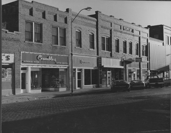
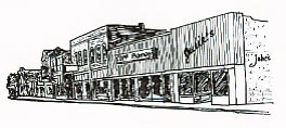
Kinsley Downtown Mapping Project
6th St, 100 block, South Side

Click image to enlarge.
 Click title for description and copyright.
1895 - Edwards and Nobel -Austrian China Plate
c1900 - Edwards Store and Bank
c1900 - Looking east on Sixth Street
c1900 Knights of Pythias
c1905 - West end of Sixth St.
c1908 - 2512 Main St. Kinsley Kan
1910 U. S. Post Office
c1910 - Edwards & Noble Grocery
1911 Wilson Building
1911 Edwards, Noble & Co. Department Store
1911 Hotel Davenport
c 1911 - Blankenship Clothing
Davenport Hotel Room
c 1912 - Farmers State Bank bldg
1912 - Blizzard of 1912, Feb. 25th
c 1912 - Main Street, Looking East, Kinsley, Kans.
c1914 - Mairs & Draut Insurance/ Real Estate
1916 West & Frazier Grocery
1917 - PalaceHotel
c 1918 - E. Sixth Street Kinsley KAS
c1923 - Main Street Kinsley Kans
c1927 - Main Street Kinsley Kans
1953 - Safeway Store
1953 - Mercury Office - Mrs. Brodbeck & Jesse Fravel
1963 - Main Street
1965 - Aerial View look east
1978 Gifford Jewelry
1978 South Side of 100 Block
1978 - Gambles & Youngs
1981 - Kinsley Fair Parade
1981 - Discount Food Center - Fair Parade
1983 - Rear of Sears Catalog Store
1985 Discount Food
1985 Giffords & Owls Nest
1985 Rapps and V&S
1985 True Value
1985 Youngs
1985 State Farm & Sears
1985 Sears
1985 Night scene
1985 Inside Youngs
1985 - Inside Youngs Pool Hall
1985 Rear Entrance Gamble Store
1985 - Rear of Discount food & Gifford Jewelry
2001 Circle K Auto Parts
2001 Circle K/Gifford Jewelry/Owls Nest/Dotties Shop
2001 Gifford Jewelry
2001 Owls Nest/Dotties Shop/old Duckwall Store
2001 Carnival Heritage/Youngs
2001 Youngs/Ryan Appliance
2001 Back of 100 block/Owls Nest/Gifford s/Circle K Auto
2005 Carnival Heritage/Youngs


Site design and development by Don Benish